Results
Approximately 80% of mobility in big African cities is based on paratransit transportation systems: since almost any family owns private cars and since reliable and affordable public transportation systems are missing, collective paratransit solutions are usually preferred to formal transportation. The lack of adequate, safe and accessible mobility systems affects economic development in African cities and the population’s welfare, contributing to the phenomenon of transport poverty. Through analysis and production of new data, starting from information gathered from the usage of mobile connectivity, the Safari Njema project explores bottom-up and place-based mobility solutions, which are replicable and complementary to formal mobility models.
-
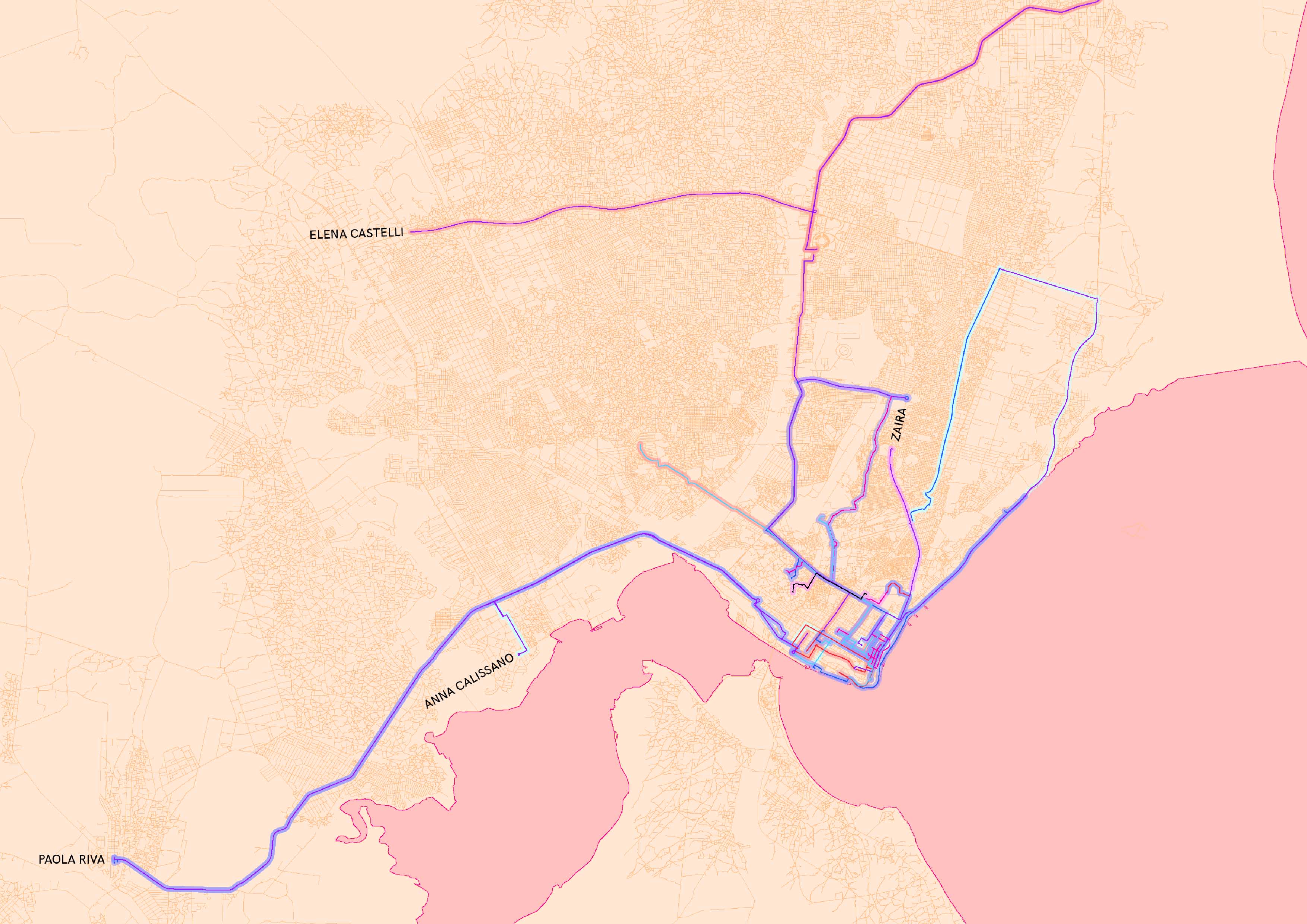
Organizing a Mapathon: first-hand experience of the transportation system in Maputo
A small mapathon was organized by Safari researchers to have a first-hand experience of the mobility systems in the city of Maputo and to associate the method of transportation to the movement of mobility users. During the II Sustainable Mobility Week (Semana da Mobilidade Sustentável da Área Metropolitana de Maputo) organised in September 2019 by Agência Metropolitana de Transporte de Maputo (AMT), a team of Safari researchers explored the city with formal and paratransit methods...
-
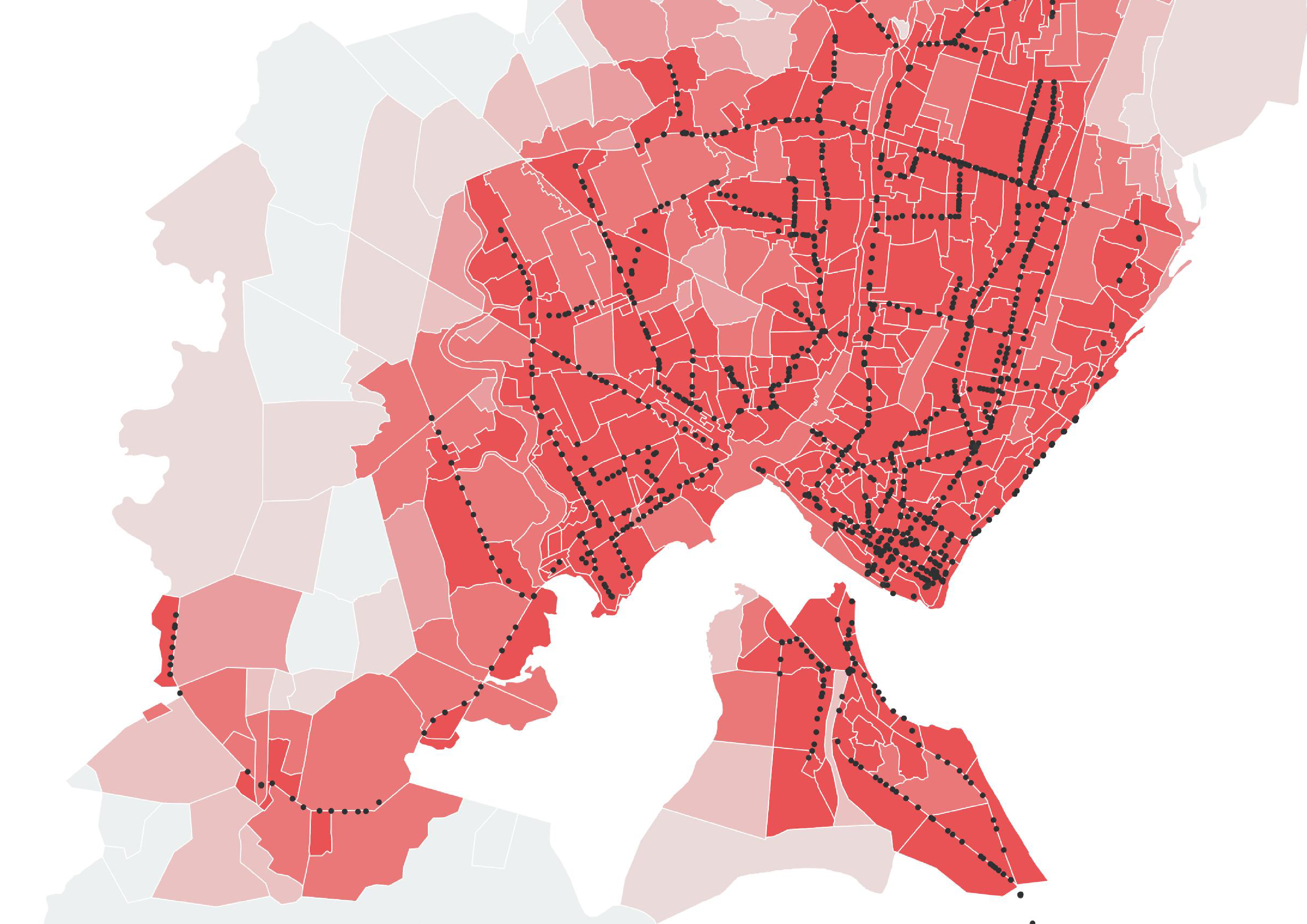
Accessibility, equity and social exclusion
Despite the significant growth of the country in the last three decades, more than half of Mozambican population still lives below the poverty line. In Mozambique the main urban growth happened in Greater Maputo Area and the rapid growth of the capital city entails negative externalities such as new urban poor, gentrification and underserved neighborhoods. This section attempts to measure wealth and map poverty in the Greater Maputo Area at neighbor level rather than at...
-
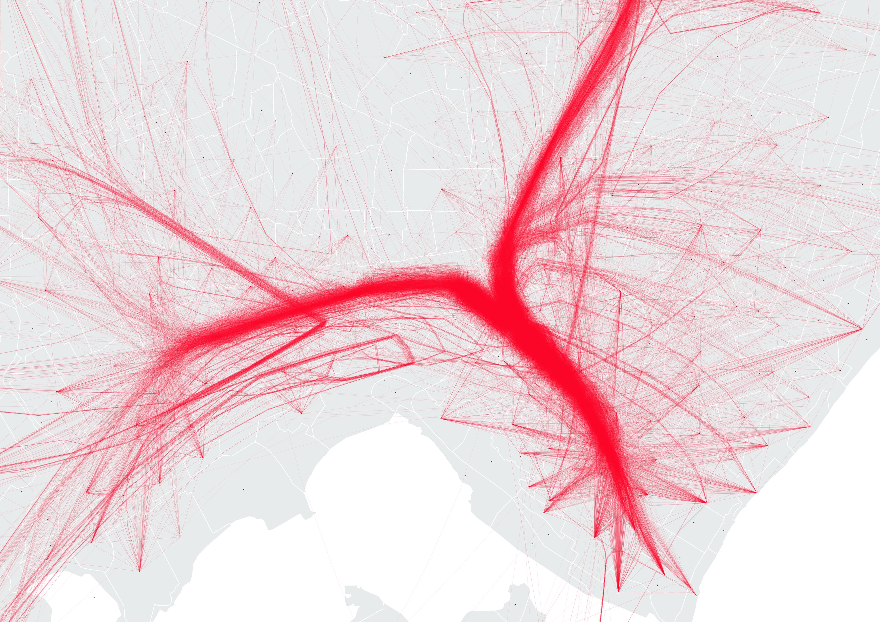
Request and Offer in Public Transport System
In the mobility setting of Maputo area, measuring mobility through GPS data can have a two-side effect. On one side, local transport authorities can use the analysis results to better map and optimize the offer of public transport system. On the other side, citizens can also access to more informative description of the public transport system. Building origin-destination matrices is a first step towards the measurement and the understanding of the phenomenon. Objectives In the...
-
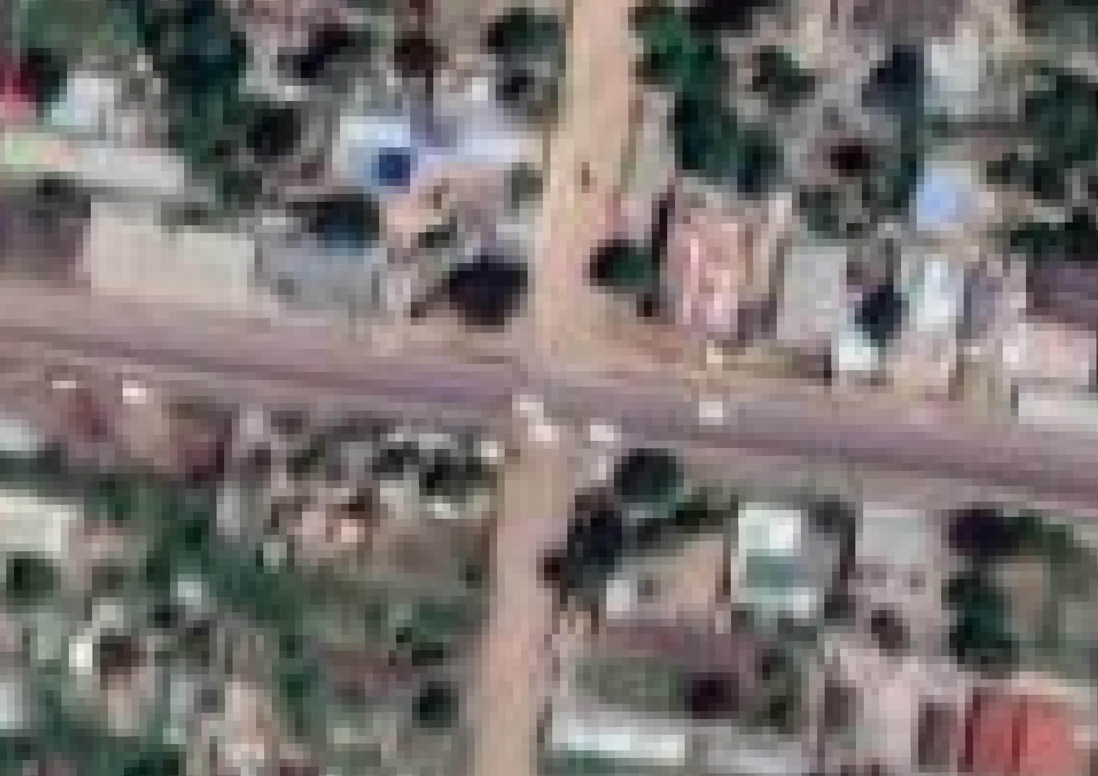
Automatic Road Pavement Detection
In large African cities as Maputo, road conditions highly affect the mobility system, preventing some transportation means to access specific roads, discouraging rides along specific routes and flooding traffic along few highly-maintained corridors. Automatic road pavement detection consists in the development of a machine learning pipeline aimed at the classification of road surfaces, based on the colour of the pavement and its particular location. The results of this analysis can help decision making processes of...
-
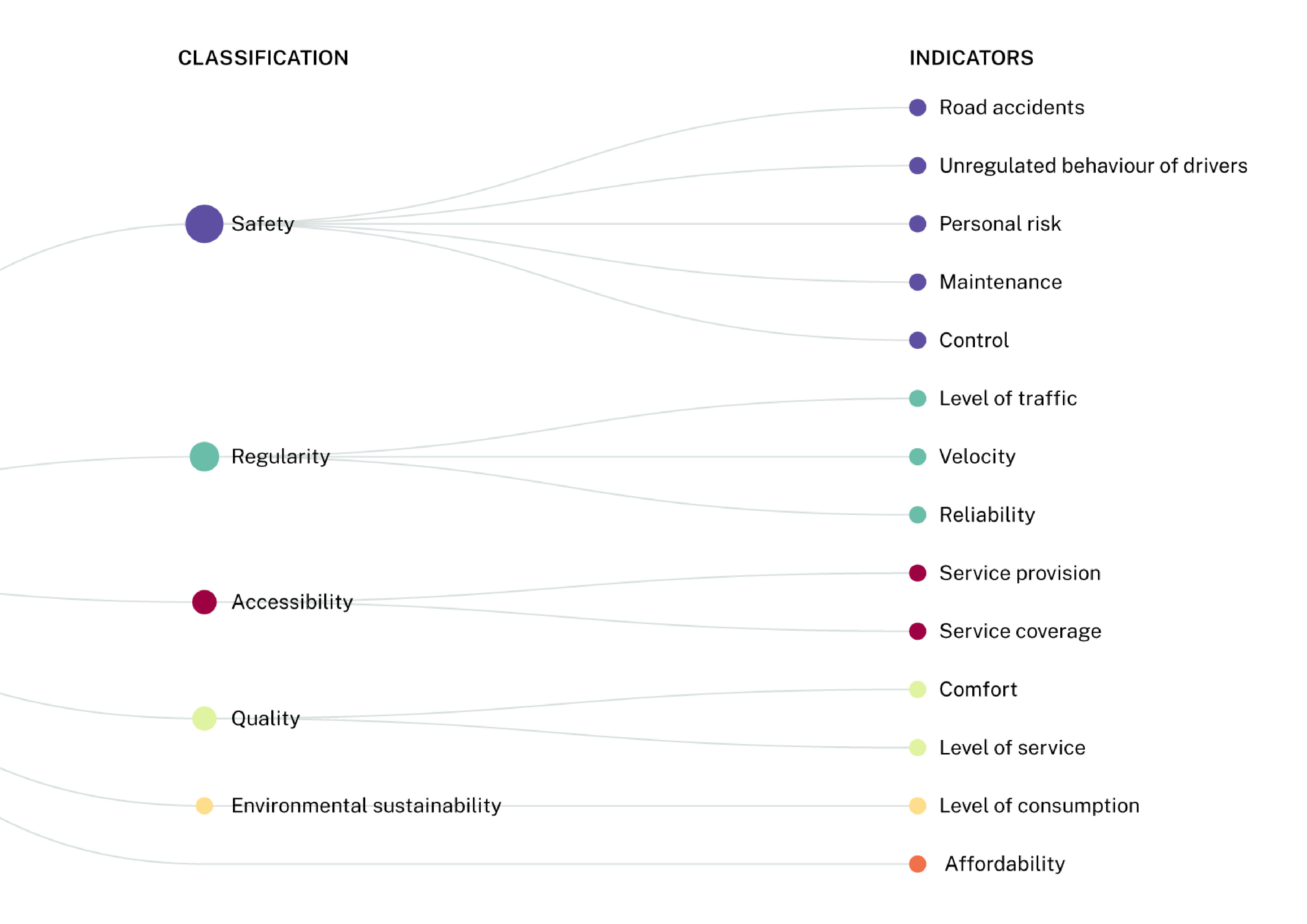
Performance Measurement System for Formal and Paratransit Mobility in Sub-Saharan Africa
Designing an efficient mobility system affects not only the transportation service but has also consequences in terms of economic growth and social integration, since efficient transportation service exacerbates poverty and inequality. This motivates the development of this specific study within the Safari project, concerned with the management of transportation systems characterized by both formal and paratransit forms of mobility in the particular context of Sub-Saharan African (SSA) countries, where Maputo (Mozambique) has been selected as...
-

Mapping and representing informal transport: state of the art
In most of the Sub-Saharan African cities, where paratransit services are highly diffused, there isn’t an official mapping of the transport lines and stops. However, there are few projects where communities of users or researchers tried to map paratransit transports within a city. Objectives This section describes the state of the art of informal transport mapping in Sub-Saharan Africa, presenting some examples of visual maps retrieves from past projects. Other projects can be found here....